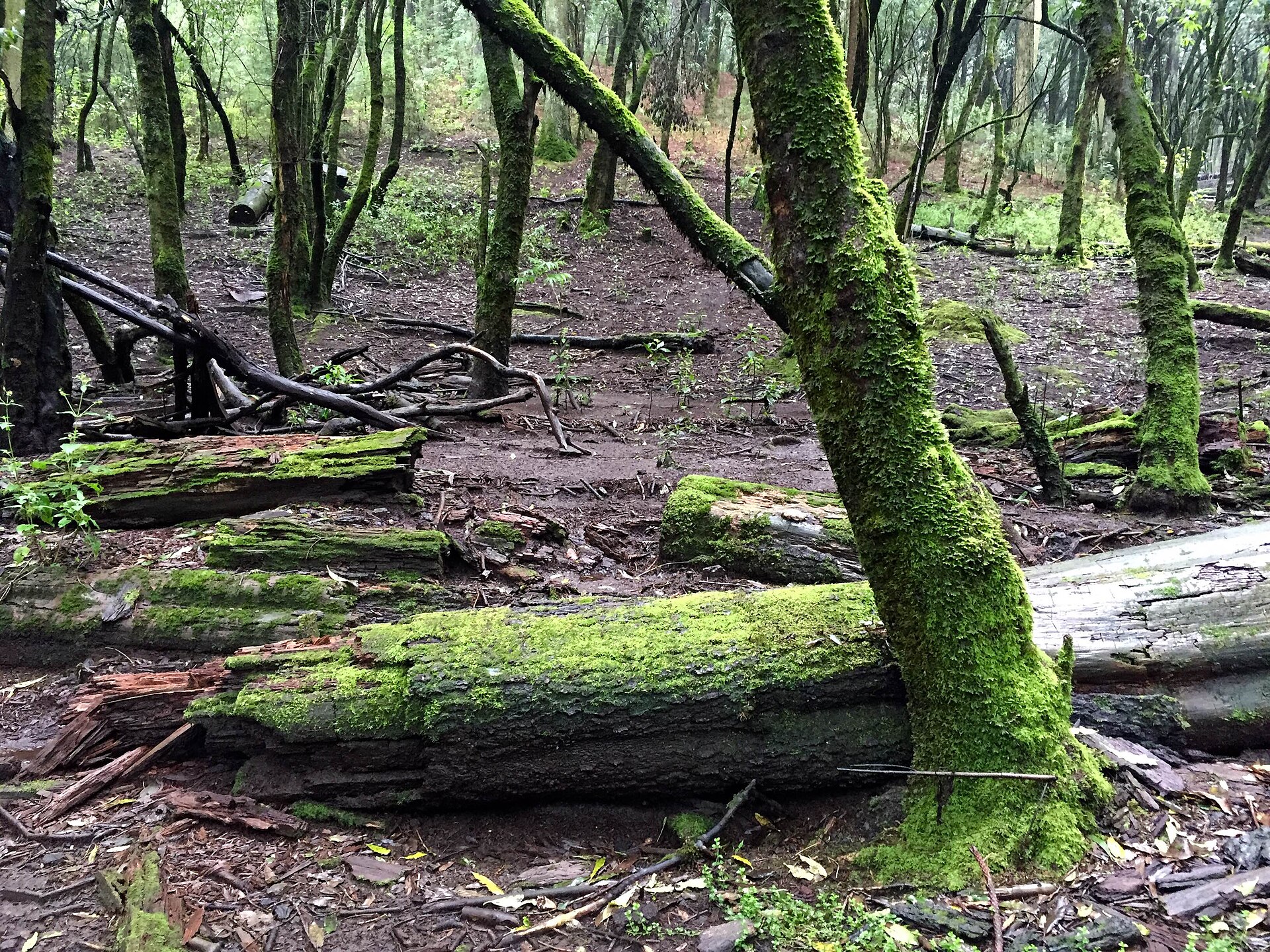
The Desierto de los Leones is neither a desert nor has it ever had lions. It is a dripping, moss-hung pine and oak forest at around 3,000 metres on the western rim of the valley, and on a wet morning it feels closer to Galicia than to anything you expect of Mexico. That gap between the name and the place is a fair introduction to mexico city parks and outdoor activities generally: this is a highland city ringed by volcanoes, with the highest ground inside its own boundary standing at 3,936 metres — and the outdoor options here are far better, far colder and far steeper than a visitor planning a museum week tends to assume.
The short answer: pick your green space
| You want… | Go to… | Effort | Hours and cost |
|---|---|---|---|
| Everything, in one park | Bosque de Chapultepec | Flat, easy | Free; sections vary, closed Mondays |
| A shaded run or walk | Viveros de Coyoacán | Flat, 2 km circuit | Free, daily 06:00–18:00 |
| A neighbourhood park to sit in | Parque México and Parque España | None | Free, always open |
| Real forest, an hour from Roma | Desierto de los Leones | Moderate; ~3,000 m | ~10.50 MXN, Tue–Sun 06:00–17:00 |
| Pine forest without leaving the city | Bosque de Tlalpan | Gentle hills | Free; reported 05:30–17:00 |
| A summit | Ajusco — Pico del Águila or Cruz del Marqués | Hard. 3,880–3,936 m | Free; daylight only |
| Canals, chinampas and axolotls | Parque Ecológico de Xochimilco | Flat | Low cost; guided walks often by donation |
| Cycling a closed avenue | Muévete en Bici, Reforma | Flat | Free, most Sunday mornings |
| Long opening hours and modern facilities | Parque La Mexicana, Santa Fe | Flat | Free, daily 05:00–22:00 |
Two rules govern all of it. The altitude is the constraint, not the distance. A two-kilometre walk in Viveros is nothing; a two-kilometre climb on Ajusco at nearly 4,000 metres is a serious undertaking for anyone who arrived from sea level four days ago. And the weather is a daily decision: rain comes in a heavy late-afternoon burst from May to October, and the city periodically declares an air-quality contingency that specifically advises against strenuous outdoor activity.
Before you go anywhere: altitude and air
Mexico City sits at 2,240 metres, with roughly a quarter less oxygen than at sea level. Most people adjust within one to three days, and this is below the level at which serious altitude illness becomes likely — so this is a planning constraint rather than a medical emergency. But everything in this article happens above that, some of it a great deal above.
| Place | Altitude | Above the city centre |
|---|---|---|
| Centro Histórico | ~2,240 m | — |
| Bosque de Tlalpan | ~2,400 m | +160 m |
| Desierto de los Leones | ~3,000 m | +760 m |
| Pico del Águila, Ajusco | 3,880 m | +1,640 m |
| Cruz del Marqués, Ajusco | 3,936 m | +1,696 m |
Practical consequence: give yourself three days in the city before attempting Ajusco, and two before the Desierto de los Leones. Drink a great deal more water than feels necessary. Go gently on alcohol the night before. Anyone with a heart or lung condition should take their own doctor’s advice about high-altitude exertion rather than ours — we give planning information here and nothing more.
Air quality. The valley traps pollution. When ozone or particulates spike the city declares a contingencia ambiental and advises reducing strenuous outdoor activity, particularly between 13:00 and 19:00. Readings by district are published at aire.cdmx.gob.mx. Check it on the morning of any hiking or cycling day, the way you would check rain. If it is a bad day, move the walk to a museum and go tomorrow.
Bosque de Chapultepec: the one you will actually use
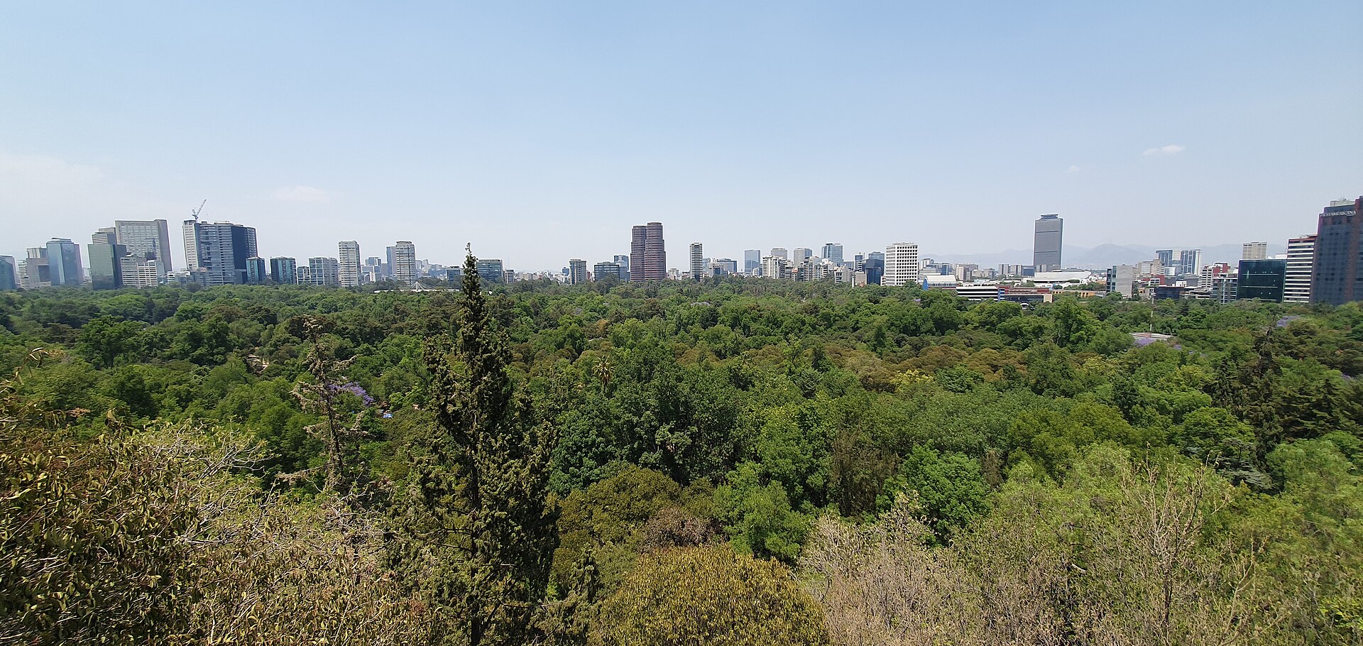
Chapultepec is one of the largest urban parks in the Western Hemisphere, and since the Chapultepec: Naturaleza y Cultura programme it has run in four sections, with the fourth opening on 24 September 2024 and Cablebús Line 3 linking them. It holds a free zoo, a free botanical garden, a lake with rowing boats, a castle, two major museums, a children’s museum, and a great deal of open ground.
- First section — the one most visitors mean: the zoo, the lake, the castle, Antropología, Papalote. Closed Mondays.
- Second section — the Museo Tecnológico, the fountains, and Aztlán Parque Urbano on the site of the old funfair.
- Third and fourth sections — wilder, quieter, much less visited, and the reason Cablebús Line 3 exists.
- Cablebús at 7 pesos on the Movilidad Integrada card is both transport and the best value entertainment in the city.
Sunday is the park’s day. Families out in numbers, food carts everywhere, and the atmosphere of a public holiday. It is also when it is busiest — if you want the paths to yourself, come on a weekday morning.
Parks you can walk to
Viveros de Coyoacán
A working forestry nursery founded by Miguel Ángel de Quevedo and opened to the public, now the city’s best running park: a shaded circuit of roughly two kilometres under mature trees, free, open daily from 06:00 to 18:00, and full of runners, squirrels and people doing tai chi at seven in the morning. Metro Viveros/Derechos Humanos on Line 3, then a short walk. It is flat, it is safe in daylight, and it is the single easiest way to get exercise in this city.
Parque México and Parque España
The two green lungs of Condesa, two blocks apart. Parque México — properly Parque General San Martín — sits inside the ellipse of Avenida Ámsterdam, which traces the perimeter of the old Condesa racetrack; it has an art deco amphitheatre, a duck pond, playgrounds, and what may be the highest concentration of dogs anywhere in Mexico. Parque España is smaller and quieter. Both are free, open, unfenced and used constantly. Walking the full Ámsterdam ellipse takes about half an hour and is one of the most pleasant free things in the city.
Alameda Central and the Centro’s green
The Alameda is the oldest public park in the Americas, laid out in 1592, sitting between Bellas Artes and the Hemiciclo a Juárez. It is a place to cross rather than to spend a day in, but it is genuinely pleasant and it is the natural pause in a Centro Histórico walk.
Bosque de Tlalpan
A protected natural area in the south of the city with genuine pine and oak forest, gentle hills, marked trails and a resident population of runners. Reported hours are 05:30 to 17:00, though sources disagree on whether it opens seven days a week or Tuesday to Sunday — check the city’s environment secretariat before making a special journey. Free. Good for a proper walk without leaving the city or gaining much altitude.
Parque La Mexicana
Modern, well-equipped and in Santa Fe, which is a long way west and a business district rather than anywhere you are likely to be staying. Its virtue is the hours — daily 05:00 to 22:00 — which makes it the option if you want to run before or after everything else is open.
Cycling: the best outdoor activity in the city
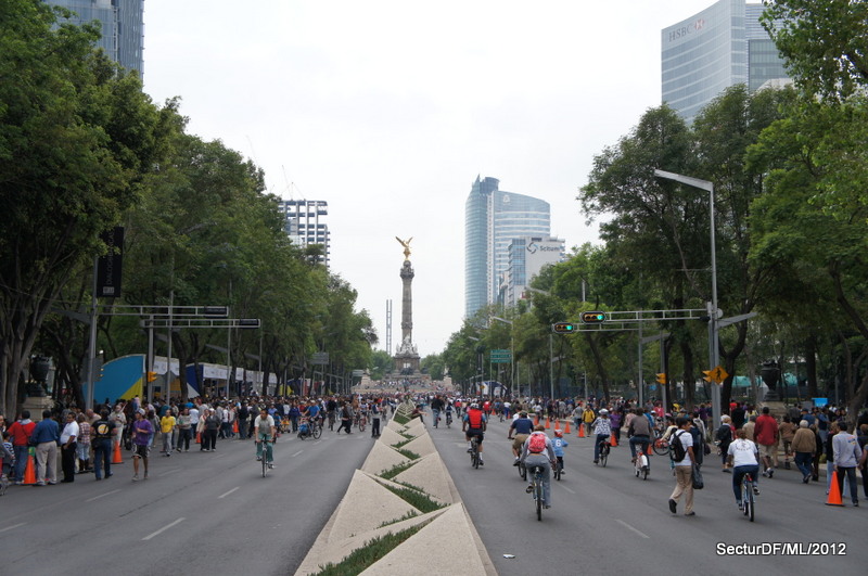
Cycling here is better than it has any right to be, for one specific reason: most Sunday mornings, Paseo de la Reforma closes to cars entirely until early afternoon for Muévete en Bici, with free loan bikes available along the route. Riding the length of Reforma with the Ángel de la Independencia ahead of you and no traffic anywhere is one of the genuinely great free experiences in Mexico City, and it needs no booking at all.
The rest of the week, Ecobici is the practical option. Tariffs checked September 2026:
| Pass | Price | Included |
|---|---|---|
| 1 day | 134 MXN | Unlimited 45-minute rides, 24 hours |
| 3 days | 263 MXN | Unlimited 45-minute rides |
| 7 days | 441 MXN | Unlimited 45-minute rides |
Overage runs 27 pesos for 46 to 60 minutes, then 54 pesos per further hour or part. The 45-minute clock resets each time you dock, so the system rewards hopping between stations rather than keeping a bike all afternoon. Registration needs a valid ID — a foreign passport is accepted — and a Visa or Mastercard, and can be done online or in the app before you arrive. Station density is highest across Roma, Condesa, Juárez, Polanco, Centro, Del Valle and Narvarte.
Two honest caveats. The protected lanes are excellent on some corridors and notional on others, and Mexico City traffic is not gentle. And at this altitude a ride that would be trivial at home will have you breathing hard for the first day or two. Our getting around guide covers the network and the transport card.
Hiking: Ajusco and the Desierto de los Leones
Desierto de los Leones — the easy one
A national park on the western rim of the valley, built around a seventeenth-century Carmelite ex-convent in dense pine and oak forest at around 3,000 metres. Open Tuesday to Sunday, 06:00 to 17:00, with an entry charge of around 10.50 pesos.
What it offers: a network of graded forest paths, the ex-convent and its gardens, the small chapels scattered through the trees, and food stalls at the entrance selling quesadillas and atole to people who have just walked in cold rain. The paths are well made and the gradients are manageable. The altitude is the thing to respect — it is 760 metres above the city, and you will notice.
Getting there: there is no direct public transport that we would recommend to a visitor. Drive, take a taxi, or go with an organised group. It is roughly forty minutes to an hour from the central colonias depending on traffic, via the Carretera México-Toluca.
What to bring: a waterproof, layers, and shoes with grip. It is genuinely colder and wetter up here than in the city, and the paths are muddy for much of the year.
Ajusco — the hard one
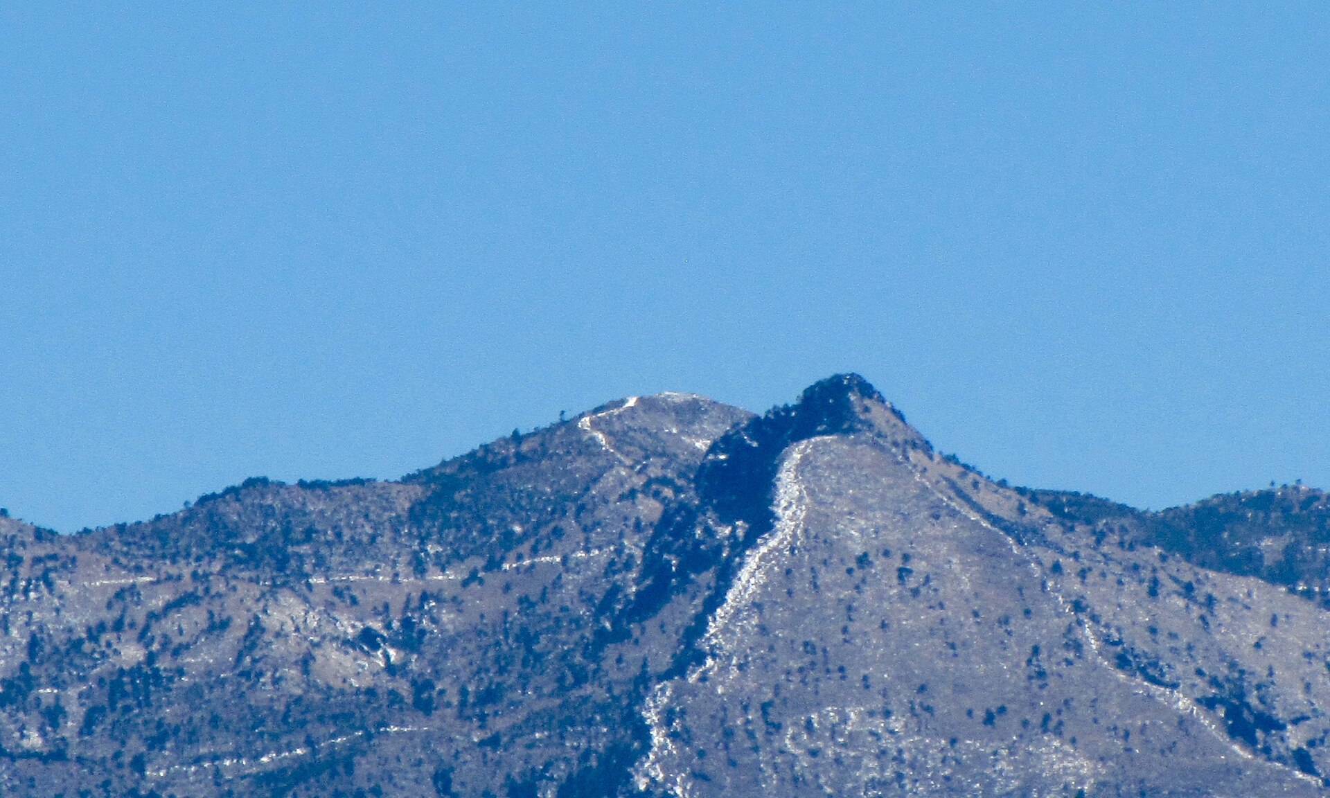
The Ajusco is a lava dome in the Parque Nacional Cumbres del Ajusco, on the southern edge of the city, and it holds the highest ground inside Mexico City: Cruz del Marqués at 3,936 metres, with Pico del Águila at 3,880 metres. Access is via the Carretera Picacho-Ajusco, under half an hour from the city’s southern perimeter.
This is a real mountain and it deserves to be treated as one. The routes are short but very steep, with a great deal of loose and slippery rock. The sources we consulted are consistent: boots rather than trainers, and trekking poles are recommended. A waterproof shell is essential from June to September. Weather on the ridge changes fast and visibility can close in within minutes.
- Do not attempt it in your first three days in Mexico. You will be climbing 1,700 metres above a city you have not yet adjusted to.
- Start early. Afternoon cloud and rain are the norm in the wet season, and you want to be descending by early afternoon in any season.
- Do not go alone. Several local operators run guided ascents, including night climbs; a guide is worth the money here for route-finding and for the descent, which is where people get hurt on loose rock.
- Tell someone your plan and your expected return time. Mobile signal is patchy.
- Carry more water and more layers than you think you need, plus food. There is nothing on the mountain.
- Descend before dark. Non-negotiable.
On safety: the Ajusco trails have at times attracted reports of robbery, which is why going in a group or with a guide, in daylight, on the main routes, is the standard local advice. Check current conditions and any advisory before setting out — our Mexico City safety guide covers how the advisories work and lists the verified emergency numbers.
Water, canals and the axolotl
The Parque Ecológico de Xochimilco covers around 165 hectares of the canal and chinampa system in the south of the city, and it is a very different proposition from the party boats at the busy landings. There are lakes, walking trails, picnic areas, playgrounds and a museum, and guided walks — many free or by donation — that cover the history of the chinampas and the conservation work on the axolotl, the salamander that exists in the wild only in these canals and is critically endangered.
If you want the trajineras rather than the trails, that is a separate outing and a separate tariff: the official Alcaldía rate is 750 pesos per hour for the whole boat, not per person, and it is cash only on the water. Our Xochimilco guide covers the landings and the tariff in detail.
Elsewhere in the south, Cuemanco has the Olympic rowing canal and a large plant market, and the surrounding working chinampas are where the most serious agricultural and conservation projects are based.
What to wear and carry
| Activity | Footwear | Essential | Season |
|---|---|---|---|
| City parks, Viveros, Chapultepec | Trainers | Water, sun protection | Any |
| Bosque de Tlalpan | Trainers or trail shoes | Water, layer | Any |
| Desierto de los Leones | Trail shoes with grip | Waterproof, warm layer | Any; muddy most of the year |
| Ajusco | Boots | Poles, shell, warm layers, food, extra water | Dry season safer; June–Sept needs full waterproofs |
| Cycling | Anything | Water, sun protection | Mornings; avoid afternoon rain |
Two things people consistently get wrong. Sun protection matters more than the temperature suggests — the UV at 2,240 metres and above is strong, and higher still on Ajusco. And evenings drop sharply year-round, so the layer you did not want at two in the afternoon is the layer you need at six.
Weather, and the return plan
The seasons here are wet and dry rather than hot and cold. Mean highs vary by only about five degrees Celsius across the year, on Servicio Meteorológico Nacional normals for the Tacubaya station, 1991–2020.
- November to April: dry, clear, and the right season for anything at altitude. March is the sunniest and warmest-feeling month. Nights are cold on the mountain.
- May to October: the rainy season, delivering roughly 59 to 176 millimetres a month, almost always as a heavy late-afternoon burst rather than all-day rain. Mornings are frequently excellent. September is the cloudiest month of the year.
The return plan is the part that matters. For everything above the city:
- Start in the morning. Be at the trailhead by 08:00 for Ajusco, 09:00 for the Desierto.
- Fix a turnaround time before you set out, and honour it whether or not you have reached the top.
- Arrange the return before you leave the city. There is no reliable taxi rank at either trailhead. If a driver brought you, agree a pickup time; if you are with a group, know when the vehicle leaves.
- Be off the mountain well before dark, and off the roads in daylight.
- Have a bad-weather alternative already chosen: Chapultepec, Viveros or a museum. There is no glory in walking a high ridge in cloud.
Three outdoor days that work
An easy day: Chapultepec end to end
- 09:00 — Metro Chapultepec, Line 1. Enter the first section while it is quiet.
- 09:15 — Zoológico de Chapultepec, free, before the crowd. 90 minutes.
- 11:00 — the lake and a rowing boat, or the Jardín Botánico.
- 12:30 — lunch from the carts along the main path.
- 14:00 — Cablebús Line 3 into the third and fourth sections. Seven pesos, and the quietest part of the park.
- 16:00 — back down. Total cost: under 100 pesos including transport.
A half day: Viveros and Coyoacán
- 07:00 — Metro Viveros/Derechos Humanos, Line 3. The park opens at 06:00 and the first hour is the best of the day.
- 07:15–08:30 — two or three laps of the circuit, roughly 2 km each, flat and fully shaded.
- 09:00 — walk twenty minutes south into the centre of Coyoacán for breakfast at the market.
- 10:30 — Jardín Centenario and Plaza Hidalgo, and the rest of the day is yours.
A full day: the Desierto de los Leones
- 08:00 — leave the city by car or taxi, about 40 to 60 minutes via the Carretera México-Toluca. Agree a pickup time before you get out.
- 09:00 — arrive. Entry around 10.50 pesos. Tuesday to Sunday only.
- 09:15–11:00 — the ex-convent, its gardens and the chapels in the trees.
- 11:00–13:30 — a graded forest path. Take the marked routes; the forest is large and the signage is imperfect.
- 13:30 — quesadillas and atole at the entrance stalls, which is half the point of coming.
- 15:00 — leave. Be off the mountain roads well before dark.
Ajusco does not appear on that list deliberately. It is a separate undertaking rather than a day out, it needs three days of acclimatisation behind you, and we would send anyone attempting it to a guided group rather than to a numbered itinerary on a travel site.
Frequently asked questions
What is the best park in Mexico City?
Bosque de Chapultepec, for range: a free zoo, a free botanical garden, a lake, a castle, two major museums and four sections linked by cable car. For a walk or a run specifically, Viveros de Coyoacán is better — flat, shaded, free and open from six in the morning.
Can you hike near Mexico City?
Yes, and better than most visitors realise. The Desierto de los Leones gives you real forest at 3,000 metres within an hour of the centre, and Ajusco gives you a genuine summit at 3,936 metres — the highest ground inside the city. Both need respect for the altitude; Ajusco needs boots, poles and ideally a guide.
Is Ajusco safe?
The mountain itself is steep with loose rock and requires proper footwear and an early start. On personal safety, the trails have at times attracted reports of robbery, and the standard local practice is to go in a group or with a guide, in daylight, on the main routes. Check current conditions before setting out rather than relying on any article, including this one.
Do I need to book anything?
Almost nothing. The parks, Muévete en Bici, Viveros, Bosque de Tlalpan and the Desierto de los Leones are all walk-up. The things worth arranging in advance are a guided Ajusco climb, a driver to the Desierto, and an Ecobici pass, which you can set up online before you travel.
When is the best time of year for outdoor activities?
November to April is dry, clear and reliably good. May to October is perfectly workable if you go out in the morning and plan to be indoors by about four in the afternoon. Our best time to visit guide has the month-by-month climate normals.
Is the air quality a problem for exercise?
Sometimes, and it is checkable. The city publishes readings by district at aire.cdmx.gob.mx, and when a contingencia ambiental is declared the advice is to reduce strenuous outdoor activity, especially between 13:00 and 19:00. Treat it as you would a rain forecast: check in the morning, and move the plan if it is bad.
Are the parks open on Mondays?
Most are. Parks, markets, churches and the Torre Latinoamericana deck stay open on the day the museums close, which makes Monday a good day for Viveros, Parque México, Bosque de Tlalpan or a Chapultepec walk. The exceptions are the paid venues inside Chapultepec — the zoo, Papalote, the castle and Aztlán — which all close on Mondays, and the Desierto de los Leones, which closes on Mondays too.
Can I run in Mexico City?
Yes, and many people do. Viveros de Coyoacán is the classic circuit; Parque México, Chapultepec and Bosque de Tlalpan all work. Run early, before the traffic and the heat, and expect your pace to be slower than at home for the first few days — the altitude is real and there is nothing wrong with you.
Is Chapultepec free?
The park is free and unfenced. The zoo and the botanical garden are free. The castle, Antropología and Papalote charge admission, and the Cablebús costs 7 pesos a ride. A full and good day in Chapultepec can cost nothing at all.
Chapultepec fits naturally into a short trip as the second day of three, after a morning in the Museo Nacional de Antropología and before dinner in Roma or Condesa. Our three-day Mexico City itinerary shows how to combine the museum, the park and the castle without running into the Monday closures.
Related Mexico City Guides
- Things to Do in Mexico City — the sights, including those inside the parks.
- Mexico City Neighborhoods to Visit — which colonias have the green space.
- Getting Around Mexico City — Cablebús, Ecobici and the transport card.
- Xochimilco — the canals, the chinampas and the per-boat tariff.
- Best Time to Visit Mexico City — rainy season and monthly climate normals.
- Mexico City Safety — advisories, and the verified emergency numbers.
- Mexico City With Kids — the free zoo, the lake boats and the Cablebús.
- Day Trips From Mexico City — Nevado de Toluca and the wider outdoor options, by state.
- Mexico City Trip Costs — what an outdoor day costs, and the Ecobici arithmetic.
- Mexico City Travel Tips for First Timers — altitude, packing and the first-day plan.
Sources and verification
- Ajusco — Cruz del Marqués at 3,936 m and Pico del Águila at 3,880 m, in the Parque Nacional Cumbres del Ajusco; the highest ground inside Mexico City. Access via the Carretera Picacho-Ajusco, under half an hour from the city’s southern perimeter. Routes described consistently as short but very steep with slippery stone and loose rock; boots and trekking poles recommended, and a waterproof jacket essential June to September. Checked 18 September 2026.
- Parque Nacional Desierto de los Leones — open Tuesday to Sunday 06:00–17:00, entry approximately 10.50 MXN. Built around a seventeenth-century Carmelite ex-convent in pine and oak forest on the western rim of the valley. Checked 18 September 2026.
- Bosque de Tlalpan — reported open 05:30 to 17:00; sources disagree on whether it opens daily or Tuesday to Sunday, and no single figure is asserted here. Managed as a protected natural area by the city’s environment secretariat (Sedema), which publishes current hours. Checked 18 September 2026.
- Viveros de Coyoacán — free, open daily 06:00–18:00. Founded as a forestry nursery by Miguel Ángel de Quevedo. Checked 18 September 2026.
- Parque La Mexicana, Santa Fe — open daily 05:00–22:00. Checked 18 September 2026.
- Parque Ecológico de Xochimilco — approximately 165 hectares covering part of the canal and chinampa system; guided walks, many free or by donation, covering the chinampas and axolotl conservation; picnic areas, playgrounds, kiosks with toilets and a museum. Checked 18 September 2026.
- Bosque de Chapultepec — expanded under the Chapultepec: Naturaleza y Cultura programme, with the fourth section opening on 24 September 2024 and Cablebús Line 3 linking the sections. The Zoológico de Chapultepec is free, Tuesday to Sunday 09:00–16:30, closed Mondays.
- Ecobici — ecobici.cdmx.gob.mx: 1 day 134 MXN, 3 days 263 MXN, 7 days 441 MXN, on 45-minute rides; overage 27 MXN for 46–60 minutes and 54 MXN per further hour; valid ID and a Visa or Mastercard required. Checked 18 September 2026. Cablebús 7 MXN via the Movilidad Integrada card.
- Muévete en Bici — Paseo de la Reforma closes to cars most Sunday mornings until early afternoon, with free loan bikes along the route.
- Xochimilco trajineras — official Alcaldía Xochimilco tariff for 2026: 750 MXN per hour per boat, capacity approximately 18, not per person. Cash only on the water.
- Altitude and air quality — Mexico City at 2,240 m with roughly a quarter less oxygen than at sea level; most people adjust within one to three days, below the threshold at which serious altitude illness becomes likely. Planning information only; no medical advice is given, and anyone with a heart or lung condition should consult their own doctor before exertion at altitude. The city declares a contingencia ambiental when ozone or particulates spike, advising reduced strenuous outdoor activity particularly 13:00–19:00; readings by district at aire.cdmx.gob.mx.
- Climate — Servicio Meteorológico Nacional normals for the Ciudad de México (Tacubaya) station, 1991–2020: mean highs 22.4–27.5 °C across the year, monthly precipitation 5.0 mm in December to 175.6 mm in August, with September the cloudiest month.
- Safety — UK FCDO advice for Mexico names street crime among the principal risks in the capital. Emergency 911; CDMX Tourist Police 55 5533 5533; Locatel 55 5658 1111. Ángeles Verdes (078) is a federal highway assistance service, not a city or trail rescue line.
Opening hours for the city’s protected natural areas change with the season and with management decisions, and where our sources disagreed — as they did on Bosque de Tlalpan’s days — we have said so rather than choosing. Nothing on this page is trail advice from personal experience: we have not walked these routes and do not claim to have. Check conditions, hours and any current advisory with the managing authority before you set out, particularly for Ajusco, and turn back if the weather or the ground says so.
Photo Credits
Forest in the Desierto de los Leones: Adentros del bosque en el Parque Nacional Desierto de los Leones by Brenda AGRE, CC BY-SA 4.0, via Wikimedia Commons.
Pico del Águila, Ajusco: Pico del Águila, en el Ajusco by Gerardo Noriega, CC BY-SA 4.0, via Wikimedia Commons.