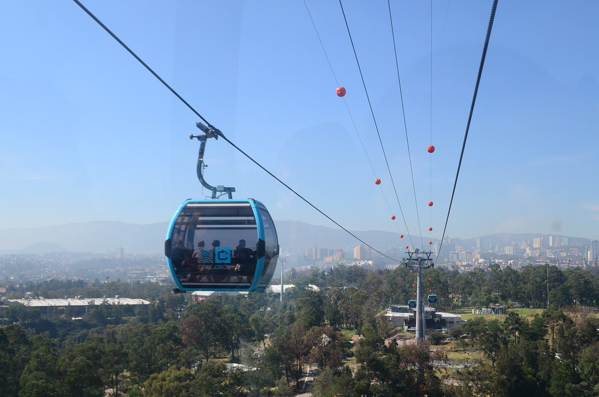
Getting around Mexico City is, on paper, one of the great bargains in world travel: the Metro costs five pesos flat to anywhere on the network, whether you are going two stops or across the entire valley. Metrobús is six. The Cablebús, which floats you over the city with a view most tourist attractions would charge for, is seven. A day of moving around this enormous city costs less than a cup of coffee in most of the places its visitors fly in from.
The catch is that this is a very large city with very bad traffic, the modes are not interchangeable, and the difference between a well-chosen journey and a badly chosen one is routinely forty minutes. This page is about choosing well: what each mode is actually for, how the payment works, one journey worked out end to end, and what to do when something breaks.
The modes, compared
| Mode | Fare 2026 | Best for | Avoid when |
|---|---|---|---|
| Metro | 5 pesos flat, any distance | Long distances, anything crossing the city, beating traffic | Peak crush with luggage; late at night alone |
| Metrobús | 6 pesos (Line 4 to the airport: 30) | Insurgentes and Reforma corridors; where the Metro does not go | Rush hour on Line 1, which is genuinely full |
| Cablebús | 7 pesos | The view; reaching the hillside districts and the fourth section of Chapultepec | You are in a hurry — it is a gondola |
| Trolebús | No 2026 increase | Eje Central and a few useful corridors | Cross-city journeys |
| Tren Ligero | No 2026 increase | Tasqueña south to Xochimilco | Anything not on that axis |
| RTP buses | No 2026 increase | Filling gaps | If you do not read Spanish route boards |
| Ride-hailing apps | Variable, cheap by international standards | Nights, luggage, groups, anywhere awkward | Rush hour — you will sit in the traffic you paid to avoid |
| Sitio taxis | Metered or agreed | From a rank or a hotel | Never hail one in the street |
| Ecobici | Short-term visitor pass | Roma, Condesa, Juárez, Polanco, Centro | Long distances or hilly ground |
| Walking | Free | Inside any single colonia | Between colonias — the distances defeat you |
The single most useful principle: build your days inside one district and you will walk; build them across districts and you will sit in traffic. The Centro Histórico, Roma, Condesa, Polanco and Coyoacán are each thoroughly walkable inside themselves. Between them, take the Metro.
The card: buy one on day one
Everything above runs on a single rechargeable card — the Movilidad Integrada card. It covers the Metro, Metrobús, Trolebús, Cablebús, Tren Ligero, RTP and Ecobici, and on several of those it is the only accepted payment.
- Buy it from a machine at any Metro or Metrobús station. The card costs a small one-off fee and you then load credit onto it.
- Load 150 to 300 pesos on arrival. At five and six pesos a journey that is a great many journeys, and topping up is the only friction in an otherwise seamless system.
- One card per person. You cannot pass it back through a turnstile for a second traveller.
- Machines take cash and often cards, and the interface is in Spanish. There are usually staff nearby.
- Keep it. It does not expire, and the credit stays on it between trips.
Doing this in your first hour removes a daily irritation for the rest of the trip. It is also the only way to pay for the Metrobús from the airport, which is a useful thing to already own when you land.
The Metro, in practical detail
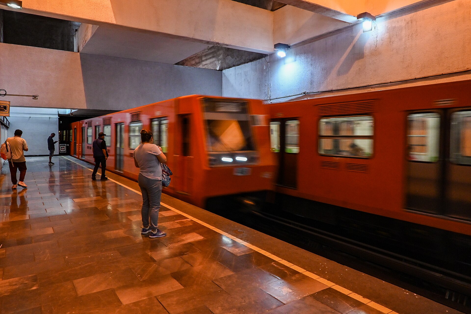
Twelve lines, hundreds of stations, several million journeys a day, and one of the cheapest fares of any major system in the world.
How to read it
Each line has a number, a colour and — the genuinely charming part — every station has an icon as well as a name, designed in the 1960s for a population with low literacy rates. A grasshopper for Chapultepec, a cannon for Balderas, a lion for Chapultepec’s zoo end. Once you start navigating by icon rather than by reading, the system becomes much faster.
Directions are given by the terminus station, not by compass direction. Look for Dirección Pantitlán or Dirección Observatorio on the platform signage and match it to your map.
The rules that matter
- Women-and-children carriages. On many lines the front carriages are reserved for women and children at peak hours. This is signposted, physically separated by barriers on the platform, and enforced. Men get it wrong regularly and are turned back.
- Bags. There are size limits and large luggage is a genuine problem at the turnstiles. This is why the airport Metro station is officially not recommended for arriving visitors.
- Peak crush is real. Between roughly 07:00 and 09:30 and 17:30 and 20:30, central interchanges are as full as anywhere on earth. If you have a choice, travel outside those windows.
- Keep your bag in front of you. Pickpocketing on crowded carriages is the commonest thing that happens to visitors on this system. It is not a reason to avoid the Metro; it is a reason to hold your bag.
- Interchanges can be long. Pantitlán and Tacubaya in particular involve substantial walking between lines.
Line 1, and the works to come
Worth knowing because it is recent. Line 1 (Pantitlán–Observatorio) reopened in full on 16 November 2025, after three years and four months of staged closures for a complete rebuild: twenty modernised stations, new rolling stock, and an investment reported at around 37 billion pesos. It is now the newest part of the system rather than the oldest.
Further integral works have been announced for other lines — Line 3 (Indios Verdes–Universidad), Line A for flood-risk adaptation, and Line 2 for special maintenance. Timings for these have moved around repeatedly in reporting, so treat any closure schedule you read, including this sentence, as provisional and check the Metro’s own service notices before you travel. Partial line closures here typically come with free replacement bus services, which work but are slow.
Metrobús, Cablebús and the rest
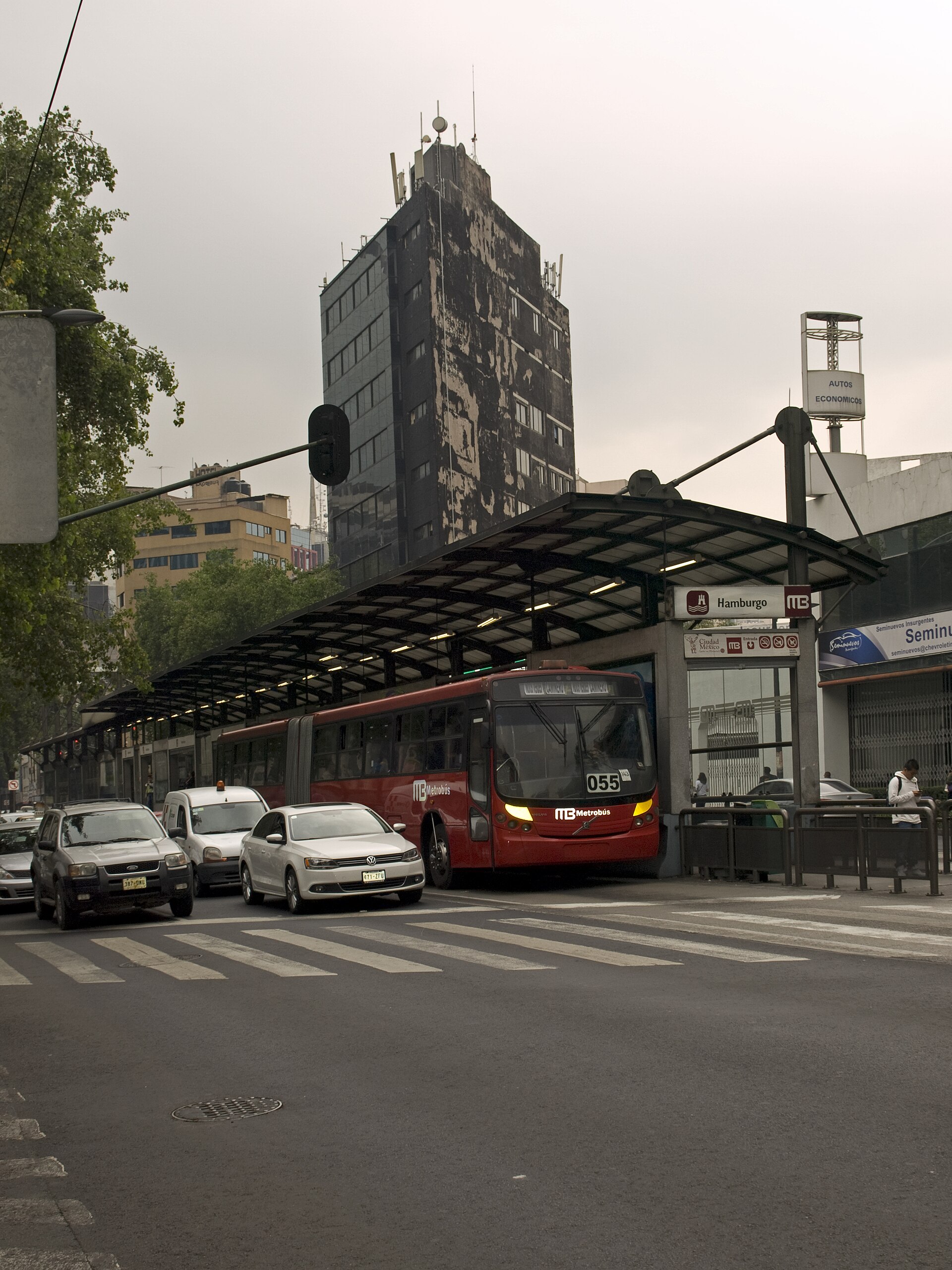
Metrobús is bus rapid transit: articulated buses in a dedicated central lane, with enclosed median stations you pay to enter, level boarding and no on-board fare collection. It behaves far more like a tram than a bus.
For visitors, Line 1 along Avenida Insurgentes is the important one — it runs the length of the city north to south past Roma, Condesa and the Zona Rosa, and Insurgentes is claimed to be one of the longest avenues in the world. Line 7 runs along Paseo de la Reforma in double-deckers, which makes it a sightseeing route by accident: Ángel de la Independencia, Diana Cazadora, the Alameda, Bellas Artes, all for six pesos from the top deck. That is the best-value city tour available anywhere.
Line 4 serves both airport terminals at a special fare of 30 pesos, card or digital wallet only, no cash.
Cablebús is an aerial cable car built as public transport rather than as an attraction, serving hillside districts that buses struggled to reach. Line 1 runs to Cuautepec in the north, Line 2 over Iztapalapa — the longest of its kind in the world when it opened — and Line 3, which opened in September 2024, links the sections of Bosque de Chapultepec. Seven pesos, on the same card. For a visitor, Line 3 is the practical one and Line 2 is the extraordinary one: half an hour floating above a vast painted hillside neighbourhood, which is a more honest view of this city than anything from a tower.
Trolebús runs electric buses on several corridors, including an elevated line in the south-east. Tren Ligero runs from Tasqueña to Xochimilco and is how you reach the canals. RTP is the conventional city bus network, useful but hard to navigate without Spanish and without local knowledge.
And then there are the peseros — the privately run minibuses that carry an enormous share of the city’s journeys, with route boards in the windscreen, no fixed stops, and cash fares. They are cheap, ubiquitous and genuinely difficult for a visitor to use, and the honest advice is that you do not need them. Everything on a tourist’s list is reachable by Metro, Metrobús or a ten-minute app ride.
Apps, taxis and bikes
Ride-hailing
Widely used, inexpensive by international standards, and the right choice at night, with luggage, with a group, or for anywhere awkward. Practicalities: check the plate and the driver against the app before getting in, share your trip, sit in the back, and pick a clear pickup point rather than a busy junction. In heavy traffic a car is often slower than the Metro for the same journey, and you will have paid for the privilege.
Taxis
Do not hail a taxi in the street. Use an authorised sitio rank, a hotel-arranged car, or an app. This is the clearest single piece of transport advice in every government travel advisory about this city, and it is worth following literally. In any non-app taxi, agree the fare before you move.
Ecobici
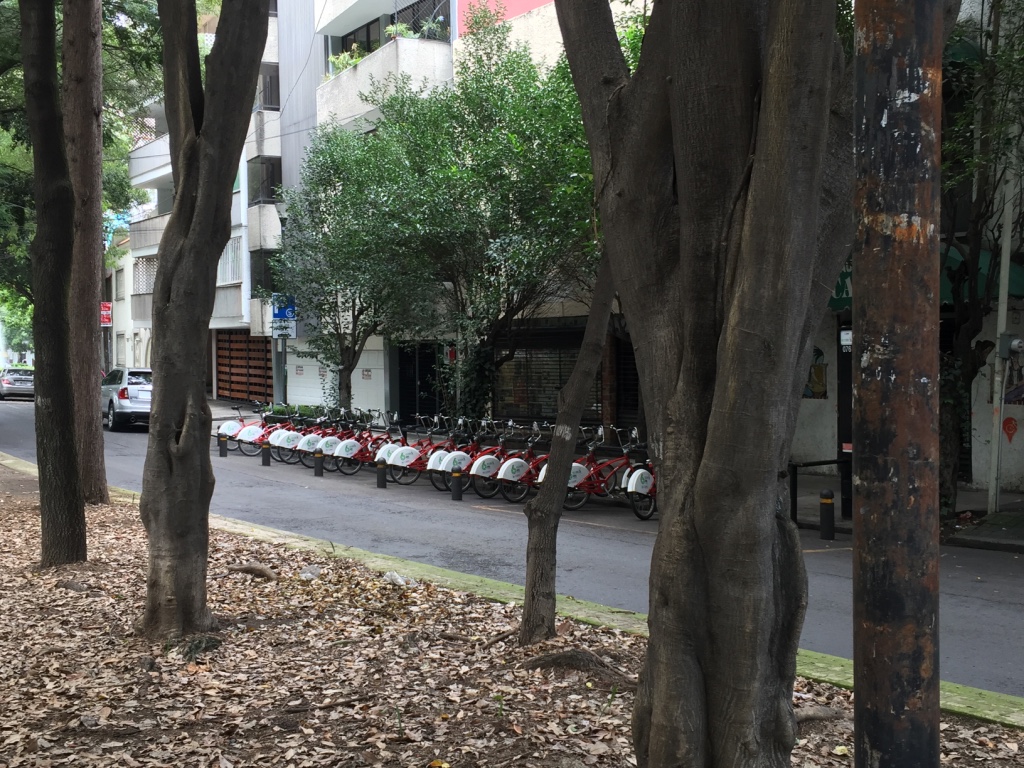
The city’s bike-share, with dense coverage across Roma, Condesa, Juárez, Polanco, Cuauhtémoc and the Centro and a short-term option aimed at visitors. Registration is done through the app. It works best precisely where walking is already pleasant, which makes it more of a pleasure than a necessity — but on a Sunday morning it is the best thing in the city.
Which brings us to the thing to actually plan around: on most Sunday mornings Paseo de la Reforma closes to cars until early afternoon for Muévete en Bici, with free loan bikes available along the route. Cycling down the middle of the city’s grandest avenue with no traffic on it is free, requires no booking, and is among the best experiences available to a visitor here.
Driving, and why not to
Do not rent a car for a trip inside Mexico City. Beyond the traffic and the parking, there is Hoy No Circula: a programme that restricts which vehicles may be driven on which days according to the last digit of the plate and the emissions sticker, with additional Saturday restrictions and tighter rules during air-quality contingencies. Out-of-state and foreign-plated vehicles are covered by their own rules. Visitors get caught by this constantly, and the fines are not small. Rent a car for day trips only, and collect it the morning you leave.
A worked journey: Roma Norte to Teotihuacán
Because a comparison table does not tell you what it actually feels like.
Goal: from a hotel on Calle Orizaba in Roma Norte to the archaeological site, arriving for opening at 09:00.
- 07:00 — Walk to Metro Insurgentes or take Metrobús Line 1 one stop. Five to ten minutes.
- 07:15 — Metro Line 1 eastbound, Dirección Pantitlán, to Balderas. Change.
- 07:30 — Metro Line 3 north, Dirección Indios Verdes, to Autobuses del Norte. About 20 minutes. Total Metro cost so far: 5 pesos. The whole journey is one fare because you have not left the system.
- 07:55 — Terminal del Norte. Exit the Metro and walk into the bus terminal. Find the Autobuses Teotihuacán counter. Ask for Los Pirámides, not the town. Buses leave every 15 to 20 minutes.
- 08:10 — Bus, roughly an hour, around 60 to 70 pesos.
- 09:10 — Arrive at the site gates.
Total outbound cost: about 70 pesos. Total time: a little over two hours. An organised tour would cost several times that and give you less time on site.
The lesson embedded in that journey: the Metro is one flat fare regardless of how many lines you use, so changing trains costs nothing. Plan your route to minimise time, not transfers.
Three shorter journeys, decided
The same reasoning applied to the routes you will actually make.
Centro Histórico to the Museo Nacional de Antropología. Metro Line 2 from Zócalo to Hidalgo, change to Line 3 to Balderas, change to Line 1 to Chapultepec — three lines, one five-peso fare, and then a ten-minute walk through the park. Around 35 to 45 minutes. A car is 25 to 35 minutes outside peak and considerably longer in it, so the Metro wins on any weekday morning and the car wins on a Sunday. Verdict: Metro, unless it is Sunday.
Roma Norte to Coyoacán. This is the journey that catches people out, because the map makes it look short and it is not. Metro Line 3 south from Hospital General or Centro Médico to Coyoacán or Viveros, then a fifteen- to twenty-minute walk into the village — about 45 to 55 minutes in total. A car is 30 to 45 minutes and drops you at the plaza. With two or more people the car costs perhaps 150 pesos and saves half an hour of walking at the end. Verdict: car southbound, Metro back.
Polanco to the Zócalo. Metro Line 7 from Polanco or Auditorio to Tacuba, change to Line 2 south to Zócalo — around 40 minutes and, again, one fare. By car it is 40 minutes on a good day and an hour and a quarter at five in the afternoon, when Reforma is solid. Verdict: Metro, emphatically, and this is the journey where the difference is largest.
The pattern across all three: the Metro’s advantage grows with distance and with traffic, and its disadvantage is the walk at either end. If both ends of your journey are near a station, take the train. If either end involves fifteen minutes on foot and you are tired, take the car — it costs a few pounds.
Navigating: addresses, colonias and the maps problem
Mexican addresses work differently from European or North American ones, and this is a bigger practical obstacle than the transport itself.
An address here is a street and number, then a colonia — the neighbourhood — then the alcaldía, the borough, then the postal code. The colonia is not decoration. The same street name recurs across dozens of colonias, and there are several Calle Morelos, several Avenida Juárez and an enormous number of streets named after the same set of national heroes. A driver given a street and number without a colonia will ask you which one, and if you do not know, you are both stuck.
- Always write down the colonia and the alcaldía along with the street and number. Photograph your hotel’s full address on day one.
- Street numbering is not reliably sequential and even and odd sides do not always correspond. Nearby cross-streets are more useful than numbers.
- Give a landmark. “Orizaba, corner of Colima, Colonia Roma Norte” will get you there; a bare number may not.
- For an app pickup, choose a named corner or a Metro entrance rather than a mid-block address. Drivers find junctions; they struggle with doorways.
- Download offline maps. Mobile data is cheap and generally good, but the Metro has no signal underground and you will want to check your line before you descend.
Small things nobody tells you
- Have small notes. A five-hundred-peso note is close to useless for a bus, a taco or a top-up machine. Break big notes in supermarkets.
- People give up seats without being asked, to older passengers, pregnant women and anyone with a child, and they do it fast. Join in.
- Stand on the right on escalators. It is observed here.
- Metro vendors walk the carriages selling sweets, headphones and music from speaker-laden backpacks. This is normal, it is not begging, and it is one of the pleasures of the system.
- Crossings are advisory. Right turns on red are common and motorbikes filter. Treat every crossing as unprotected, look twice, and do not step out on a green man without checking.
- Pavements are genuinely hazardous — uneven, obstructed, and sometimes missing a slab entirely. Watch your feet more than you would at home.
- Ask for directions. People here are unusually willing to help a lost visitor, will often walk you part of the way, and will not expect anything for it.
Accessibility
An honest assessment, because this is where Mexico City is genuinely difficult.
- The Metro is largely inaccessible. Many stations have stairs only; lifts exist at some newer and rebuilt stations, including on the modernised Line 1, but coverage is patchy and lifts are frequently out of service. Do not plan a day around them.
- Metrobús is the better public option. Stations are level-boarding with ramps and the buses have designated spaces. It is not uniformly good, but it is usable.
- Cablebús stations are modern and step-free, and cabins slow to a walking pace for boarding.
- Pavements are the real obstacle, more than the vehicles. They are uneven, frequently obstructed by parked cars and market stalls, and kerb cuts are inconsistent. Crossings are often unprotected.
- Pre-booked accessible vehicles are the reliable answer. Arrange them in advance rather than hoping to find one.
- Priority seating exists on all modes and is respected. People will stand up for you without being asked.
For visitors with reduced mobility rather than a wheelchair: the distances here are the problem, not the steps. Budget for more taxis than you would elsewhere and build shorter days.
Luggage
- The Metro is poor with luggage — narrow turnstiles, stairs, crowding — and the airport station is officially not recommended for it.
- Metrobús is better but not good. Level boarding helps; limited space does not.
- Take a car on arrival and departure days. The saving is not worth it.
- Luggage storage exists at the airport and at some hotels and hostels, but is not a widespread commercial service. If you need a day between checkout and a flight, ask your hotel first.
When it goes wrong
| Problem | What to do |
|---|---|
| A Metro line is partly closed for works | Free replacement buses run the closed section. They work and they are slow — add 30 minutes, or take a car. |
| A march or protest has closed the centre | Common on Reforma and around the Zócalo, and usually announced in advance. Go around by Metro, which runs underneath. |
| Your card has run out at a turnstile | Top-up machines are inside every station lobby. Keep a hundred pesos in cash for exactly this. |
| Air-quality contingency declared | Additional Hoy No Circula restrictions apply and traffic gets worse. Use the Metro, and move strenuous outdoor plans to the morning. |
| Your app ride cannot find you | Walk to a named corner or a Metro entrance rather than a mid-block address. Street numbering here is not always sequential. |
| You are given a street name that exists in three colonias | Always give the colonia and alcaldía as well as the street. This is the commonest navigation failure in the city. |
| It is late and you are unsure | Take an app ride. It costs less than a museum ticket and removes the question. |
What a day of transport actually costs
| Kind of day | Cost per person, MXN |
|---|---|
| Public transport only, four journeys | ~20–30 |
| Public transport plus one app ride | ~120–200 |
| App rides all day | ~400–700 |
| Airport transfer by Metrobús Line 4 | 30 |
| Airport transfer by authorised taxi | ~220–500 |
Checked September 2026. Public fares are official published rates; app and taxi figures are indicative ranges rather than quotes, and no fare survey was run for this page.
Frequently asked questions
How much does the Metro cost in Mexico City?
Five pesos, flat, to anywhere on the network, however many lines you use, paid with the Movilidad Integrada card. It is among the cheapest urban rail fares in the world.
Is the Mexico City Metro safe for tourists?
Yes, in the sense that millions of ordinary people use it every day without incident, and with the qualification that it is where most pickpocketing of visitors happens. Keep your bag in front of you, avoid the worst of the peak crush with valuables, use the women-and-children carriages if they apply to you, and be more cautious late at night.
What card do I need for public transport?
The Movilidad Integrada card, bought from a machine at any Metro or Metrobús station. It covers the Metro, Metrobús, Trolebús, Cablebús, Tren Ligero, RTP and Ecobici, and on several of those it is the only accepted payment. Load 150 to 300 pesos on day one.
Is Uber legal in Mexico City?
Ride-hailing operates widely in the city and is commonly used by residents and visitors alike. Pickup arrangements specifically at the airport have been the subject of a continuing dispute between federal transport authorities and the platforms, and that position has changed more than once — check the app’s own airport instructions when you land rather than relying on a guide.
Should I rent a car in Mexico City?
No. Traffic, parking and the Hoy No Circula plate restrictions make it an expensive way to buy a problem, and public transport plus occasional app rides is cheaper and faster. Rent a car for day trips only, on the days you need it.
What is Hoy No Circula?
A programme restricting which vehicles may be driven on which days, based on the last digit of the number plate and the vehicle’s emissions sticker, with extra Saturday rules and tighter restrictions during air-quality contingencies. Out-of-state and foreign-plated vehicles have their own rules. It catches out visitors regularly.
Is Mexico City walkable?
Inside each district, thoroughly — the Centro Histórico, Roma, Condesa, Polanco and Coyoacán are all good walking neighbourhoods. Between them, not at all; the distances are far larger than a map suggests. Build your days inside one district and use the Metro between them.
What is the Cablebús and is it worth riding?
An aerial cable car built as public transport, at seven pesos on the same card as everything else. Line 3 links the sections of Bosque de Chapultepec and is the practical one for visitors; Line 2 over Iztapalapa is the spectacular one, and gives a more honest view of this city than any observation deck.
How do I get to Xochimilco or Coyoacán?
Metro to Tasqueña, then the Tren Ligero south to Xochimilco at the end of the line. For Coyoacán, Metro Coyoacán or Viveros, both of which are a fifteen- to twenty-minute walk from the village centre — many people take a car for that last stretch.
Is Line 1 of the Metro open again?
Yes. The full Pantitlán–Observatorio route reopened on 16 November 2025 after a three-year rebuild of all twenty stations. Other lines have works announced, with repeatedly shifting timings — check the Metro’s own service notices before you travel.
The longest trip most visitors make on public transport is the one to the pyramids: Metro Line 5 to Autobuses del Norte, then a bus of about 60 pesos from Sala 8 of the terminal. Our guide to Teotihuacan by bus from Mexico City walks through it step by step, including the later weekend opening of the Metro that catches out early starters.
For the Autódromo Hermanos Rodríguez, home of the Formula 1 Grand Prix and Corona Capital, use Metro Line 9 to Velódromo, Ciudad Deportiva or Puebla, or Metrobús Line 2 to UPIICSA or El Rodeo; there is no spectator parking. Our Grand Prix travel guide has the full plan for getting there and back.
Your first journey on the city’s transport is likely to be the one from the airport. Our guide to the Mexico City airport to city center explains the 30-peso Metrobús Line 4 service (card or phone only), when the 5-peso Metro is and is not a good idea, and when a taxi is the better choice.
Related Mexico City Guides
- Mexico City Airport Guide — the airport-specific routes, including Metrobús Line 4 and the Buenavista–AIFA train.
- Mexico City Itineraries — travel-time buffers between the districts, applied to real days.
- Where to Stay in Mexico City — how well each colonia is connected, which is the main reason to choose one.
- Is Mexico City Safe for Tourists — the transport safety questions in more detail.
- Xochimilco Mexico City Guide — including the Tren Ligero journey south and getting back before dark.
Dedicated guides to using the Metro, the Metrobús, ride-hailing, Ecobici and driving in Mexico City are being published to this section over the coming weeks.
Sources and verification
- Fares, 2026: Metro 5 pesos flat regardless of distance; Metrobús 6 pesos, except Line 4 to the airport terminals at 30 pesos, payable only by Movilidad Integrada card, contactless card or digital wallet; Cablebús 7 pesos; no 2026 increase announced for Trolebús, RTP or Tren Ligero. All modes use the rechargeable Movilidad Integrada card. Checked September 2026.
- Metro Line 1: full Pantitlán–Observatorio service resumed on 16 November 2025 after three years and four months of staged closures, covering 20 modernised stations with new rolling stock, at a reported cost of around 37 billion pesos. Further integral works announced for Line 3 (Indios Verdes–Universidad), Line A and Line 2, with timings reported inconsistently. Treat any closure schedule as provisional. Checked September 2026.
- Women-and-children carriages at the front of trains on many Metro lines during peak hours, signposted and enforced. Checked September 2026.
- Cablebús: Line 3 opened September 2024, linking the sections of Bosque de Chapultepec. Checked September 2026.
- Paseo de la Reforma closes to cars on most Sunday mornings until early afternoon for Muévete en Bici, with free loan bikes along the route. Checked September 2026.
- Ecobici bike share, dense across Roma, Condesa, Juárez, Polanco and the Centro, with a short-term visitor option. Checked September 2026.
- Airport transport: Metro Terminal Aérea on Line 5 at 5 pesos, officially not recommended for arriving visitors with heavy luggage; authorised taxis at fixed zone rates sold at counters inside the terminals. Checked September 2026.
- Teotihuacán buses from Terminal del Norte every 15–20 minutes, approximately one hour. Checked September 2026.
- Rideshare at the airport: pickup arrangements disputed between federal transport authorities and the platforms; this page asserts no current lawful position. Noted September 2026.
What this page does not claim. Nobody from this site made these journeys on the dates published or timed them with a stopwatch. Published public fares are official and dated; app fares, taxi ranges and daily cost estimates are planning figures rather than quotes, and no fare survey was run. The worked journey to Teotihuacán is a route plan, not a recorded trip, and the bus fare given is a range. Metro closure schedules are the least reliable information on this page — they have shifted repeatedly, and the page tells you to check the operator rather than trusting the dates printed here. Hoy No Circula rules vary by plate, sticker, day and contingency status, and are summarised rather than reproduced in full; anyone actually driving should check the current scheme directly.
Photo Credits
Cablebús Line 3 cabin: Cabina del cablebús línea 3 by Brome 2021, CC BY-SA 4.0, via Wikimedia Commons.
Metrobús at Hamburgo station: Mexico City Metrobus Hamburgo Station by Ymblanter, CC BY-SA 4.0, via Wikimedia Commons.
The Metro at Patriotismo and the Ecobici docks in Condesa are credited on their original appearance in this site’s media library.